Blog Archives
Left Hand Creek Nature Break Video
Image yourself hanging out on Left hand Creek in Left Hand Canyon, Boulder County, Colorado. Take a Nature break…
Colorado fine art nature landscape photography and video images by James Bo Insogna (C) – All Rights Reserved.
Eyes On The Sky Spring Storms vBlog
Spring is here and storm season has arrived. Catching local, waiting and a hoping…
vBlog – Bo Insogna, www.MrBo.com Time lapse of storms coming in over the Colorado Rockies and heading east where the real action is right now.
Aspen Tree Colonies Dreaming BW

Black and white dreamy surreal abstract of aspen trees in the Colorado Rocky Mountain forest.

Aspen Tree Colonies Dreaming BW Art Prints custom order here
Colorado fine art nature landscape photography poster prints, decorative canvas prints, acrylic prints, metal prints, corporate artwork, greeting cards and stock images by James Bo Insogna (C) – All Rights Reserved.
Autumn Aspen Tree Trunks In Their Glory Dreaming
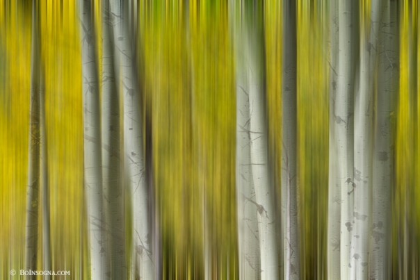
Dreamy surreal abstract of aspen trees in the colorful Colorado autumn season.

Colorado fine art abstract nature landscape photography poster prints, decorative canvas prints, acrylic prints, metal prints, corporate artwork, greeting cards and stock images by James Bo Insogna (C) – All Rights Reserved.
Bull Elk Forest Gazing

A surreal artsy ICM view into the Colorado rocky mountains high elevation forest with a beautiful bull elk during rut season.

Colorado fine art nature landscape wildlife photography poster prints, decorative canvas prints, acrylic prints, metal prints, corporate artwork, greeting cards and stock images by James Bo Insogna (C) – All Rights Reserved.

Surreal Colorful Aspen Tree Magic Abstract Art

A very colorful autumn aspen tree forest in the Colorado Rocky Mountains high country area processed as surreal abstract art. Number two of two in this series. Vertical Image. This is done with some motion blur effect. Read the rest of this entry

A Surreal Aspen Tree Abstract View

A surreal abstract view into a Colorado autumn aspen tree forest high up in the Rocky Mountains with golden grass and blue sky. Read the rest of this entry

Surreal Aspen Tree Magic Abstract Art

Colorful autumn aspen tree forest in the Colorado Rocky Mountains processed as surreal abstract art. Number one of two in this series. This was such a great trip with a ton of fantastic image. Loved playing with a few of these images for some abstract art. Read the rest of this entry
Flowing St Vrain Creek Black and White

St. Vrain Creek often known locally as the St. Vrain River is a tributary of the South Platte River, approximately 32.2 miles long, in north central Colorado in the United States. It drains part of the foothills north of Boulder and the Colorado Piedmont area in the vicinity of Longmont.
Read the rest of this entry
Flowing St Vrian Creek

St. Vrain Creek often known locally as the St. Vrain River is a tributary of the South Platte River, approximately 32.2 miles long, in north central Colorado in the United States. It drains part of the foothills north of Boulder and the Colorado Piedmont area in the vicinity of Longmont.The creek is formed by the confluence of North and South St. Vrain creeks at Lyons. The creek rises in several branches in the foothills of the Front Range northwest of Boulder. Middle St. Vrain Creek rises along the continental divide, west of St. Vrain Mountain.
It descends in canyon to flow along State Highway 7 and past Raymond. It joins the shorter South St. Vrain Creek about two miles below Raymond. North St. Vrain Creek rises northeast of St. Vrain Mountain near Allenspark and descends in a canyon to the east along U.S. Highway 36. The two branches join at Lyons, at the mouth of the canyon. East of Lyons, the combined stream flows southeast through farmland and ranch country, passing south of Hygiene and entering Longmont.
It passes through the south side of Longmont where it is rimmed by a greenway trail and several parks. East of Longmont it flows generally northeast, meandering through a wide river bottom in ranch country and passing under Interstate 25 south of the intersection with State Highway 66. It joins the South Platte from the west just upstream from the ruins of Fort St. Vrain and approximately 4 miles northwest of Platteville. Source: wikipedia
Colorado Fine art nature landscape photography poster prints, decorative canvas prints, acrylic prints, metal prints, corporate artwork, greeting cards and stock images by James Bo Insogna http://www.BoInsogna.com

