Blog Archives
Cascading Water On A Rocky Mountain Stream
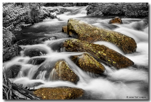
A black and white with selective coloring long exposure of beautiful cascading water and giant rocks on a rocky mountain stream in Colorado’s Roosevelt National Forest flowing down from the majestic continental divide.
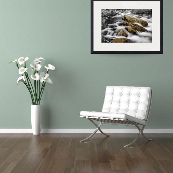

Cascading Water And Rocky Mountain Rocks Framed Print

Cascading Water and Rocky Mountain Rocks Shower Curtain
“Cascading Water and Rocky Mountain Rocks” shower curtain by James BO Insogna. 100% polyester fabric. 71″ wide x 74″ tall. Ships within 2 – 3 business days. Our shower curtains are made from 100% polyester fabric and include 12 holes at the top of the curtain for simple hanging from your own shower curtain rings. The total dimensions of each shower curtain are 71″ wide x 74″ tall.
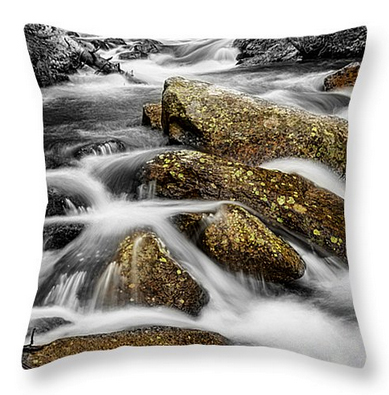
Cascading Water and Rocky Mountain Rocks Throw Pillow
“Cascading Water and Rocky Mountain Rocks” throw pillows by James BO Insogna. 100% cotton. Available in multiple sizes. Ships within 2 – 3 business days. Our throw pillows are made from 100% cotton fabric and add a stylish statement to any room. Pillows are available in sizes from 14″ x 14″ up to 26″ x 26″. Each pillow is printed on both sides (same image) and includes a concealed zipper and removable insert (if selected) for easy cleaning.

Cascading Water and Rocky Mountain Rocks Tote Bag 18″ x 18″
“Cascading Water and Rocky Mountain Rocks” tote bag by James BO Insogna. Poly-poplin fabric. Multiple sizes available. Ships within 2 – 3 business days. Our tote bags are made from soft, durable, poly-poplin fabric and include a 1″ black strap for easy carrying on your shoulder. All seams are double-stitched for added durability. Each tote bag is machine-washable in cold water and is printed on both sides using the same image, shown above.

Cascading Water and Rocky Mountain Rocks Queen Duvet Cover
“Cascading Water and Rocky Mountain Rocks” microfiber duvet cover by James BO Insogna. Hand sewn. Includes a hidden zipper for easy washing and assembly. Available in twin, full, queen, and king. Ships within 2 – 3 business days. Queen (88″ x 88″) Duvet Cover
Our soft microfiber duvet covers are hand sewn and include a hidden zipper for easy washing and assembly. Your selected image is printed on the top surface with a soft white surface underneath. All duvet covers are machine washable with cold water and a mild detergent.
Colorado fine art nature landscape photography fine art prints, framed prints, canvas prints, acrylic prints, metal prints, phone cases, throw pillows, duvet covers, greeting cards and stock images by James Bo Insogna (C) – All Rights Reserved.
Colorado Rocky Mountain Love

Please click on the image for the iGallery
You have to love the Colorado Rocky Mountains with Lake views like this! One of my most favorite places on earth Brainard Lake, the Indian Peaks Wilderness Area, Roosevelt National Forest, Boulder County, Colorado. You are looking at the continental divide, I used to camp up here in the middle of winter and cross county ski up to the bowls. Just me and my dog Jeff. Great times to remember, but those days are gone. You never know though…. the snow shoeing is really good here too.

Put a little Rocky Mountain Love above your bed.
Order Prints, Framed Prints and Canvas Prints on ImageKind HERE
Buy Royalty Free Stock Photography Images and Licensing HERE
Colorado fine art nature landscape photography images by James Bo Insogna (C) – All Rights Reserved.
Medicine Bow Snowy Mountain Range Wyoming Lake View Video
Scenic lake view of the Medicine Bow Mountain Range in Wyoming west of Laramie. High elevations, peaks and lakes dominate the southern and northern reaches of the range, with lower, forested ridges being the mainstay in between.
On the western fringes of the central portion of the range, the North Platte River cuts a deep, narrow, canyon over 20 miles long. The range features 18 peaks over 11,000 feet and includes 9 over 12,000 feet, with 12,951 ft. Clark Peak being the highest.
Please Check out some of the NEW fine art nature images from this photo shoot in the iGallery at http://james-insogna.artistwebsites.com
Music by Media productions
Video by James Bo insogna (C) all rights reserved.
Medicine Bow Mountain Range Lake Panorama
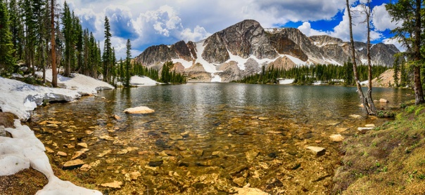
Panorama scenic lake view of the Medicine Bow Mountain Range in Wyoming west of Laramie. Two and half hour drive from Boulder County, Colorado. Great day trip. This is a very large 12 portrait images stitched together fine art panorama print.
The Medicine Bow Mountains are a mountain range in the Rocky Mountains that extend for 100-mile from northern Colorado into southern Wyoming. The northern extent of this range is the sub-range the Snowy Range. From the northern end of Colorado’s Never Summer Mountains, the Medicine Bow mountains extend north from Cameron Pass along the border between Larimer and Jackson counties in Colorado and northward into south central Wyoming. In Wyoming, the range sits west of Laramie, in Albany and Carbon counties to the route of the Union Pacific Railroad and U.S. Interstate 80.
High elevations, peaks and lakes dominate the southern and northern reaches of the range, with lower, forested ridges being the mainstay in between. On the western fringes of the central portion of the range, the North Platte River cuts a deep, narrow, canyon over 20 miles long. The range features 18 peaks over 11,000 feet and includes 9 over 12,000 feet, with 12,951 ft. Clark Peak being the highest.

- Custom order this image as Fine Art Prints, Framed Prints, Canvas Prints, Acrylic Prints, Metal Prints, Phone Cases, Throw Pillows and Duvet Covers at BoInsogna.com HERE
- Order Prints, framed Prints and Canvas Prints on Striking-Photography.net HERE
- Buy Royalty Free Stock Photography Images and Licensing HERE
Colorado fine art nature landscape photography images by James Bo Insogna (C) – All Rights Reserved.
Left Hand Creek Nature Break Video
Image yourself hanging out on Left hand Creek in Left Hand Canyon, Boulder County, Colorado. Take a Nature break…
Colorado fine art nature landscape photography and video images by James Bo Insogna (C) – All Rights Reserved.
Leading Strike

This storm packed a lot of rain, so the only thing you can do in that case is find a place with a over hang, porch or park shelter. It was tough finding something with a good composition so here we are at McIntosh lake East end view to Longs Peak in the far distance. Longmont, Colorado, NE Boulder County. Number one is safety the number two is protect your gear.

- Custom order this image as Fine Art Prints, Framed Prints, Canvas Prints, Acrylic Prints, Metal Prints, Phone Cases, Throw Pillows and Duvet Covers at BoInsogna.com HERE
- Order Prints on Striking-Photography.net HERE
- Buy Royalty Free Stock Photography Images and Licensing HERE
Colorado fine art nature landscape lightning weather photography images by James Bo Insogna (C) – All Rights Reserved. Read the rest of this entry
Plains – Dunes and Rocky Mountains Panorama Art

This is a very large nine image panorama view of Great Sand Dunes National Park and Preserve. Scenic landscape of the plains meeting the dunes and the sow covered springtime Colorado Rocky Mountains. If you have never been there, you might want to place this on your to see or bucket list. Great camping, hiking and fun to be had here.
Great Sand Dunes National Park and Preserve is a United States National Park located in the San Luis Valley, in the easternmost parts of Alamosa County and Saguache County, Colorado on the front range of the Rocky Mountains.

Order Prints on Striking-Photography.net Here
Buy Royalty Free Stock Photography Images and Licensing HERE
Colorado fine art nature landscape photography prints and stock images by James Bo Insogna (C) – All Rights Reserved.
Great Sand Dunes National Park and Preserve Panorama BW

This is a very large eighteen image black and white panorama view of Great Sand Dunes National Park and Preserve. Black and white has always been my favorite so when it seems fitting, I do a color and black and white version. This image can be printed up to seven feet long.
This is a scenic landscape view of the plains meeting the dunes and the snow covered springtime Colorado Rocky Mountains. Park elevations range from 7,515 feet to 13,604 feet above sea level. In the summer, the sand surface can reach 150°F

Colorado black and white monochrome fine art nature landscape photography and stock images by James Bo Insogna (C) – All Rights Reserved.
Buy Royalty Free Stock Photography Images and Licensing HERE
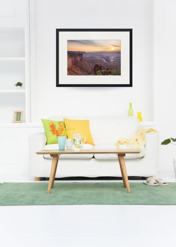
Canyonlands Utah Sunrise

This was one of the last stops on our road trip from Colorado to Arizona and back again through Utah. We ended here at night and woke up to this beautiful scenic landscape.
Canyonlands National Park is located in southeastern Utah near the town of Moab. It preserves a colorful landscape eroded into countless canyons, mesas, and buttes by the Colorado River, the Green River, and their respective tributaries. Legislation creating the park was signed into law by President Lyndon Johnson on September 12, 1964
The park is divided into four districts: the Island in the Sky, the Needles, the Maze, and the rivers themselves. While these areas share a primitive desert atmosphere, each retains its own character. Two large river canyons are carved into the Colorado Plateau by the Colorado River and Green River.
Weird fact: Nineteenth century cowboys corralled wild horses onto today’s Dead Horse Point State Park. Supposedly, one herd left on the point died of thirst.
Scientific fact: Cataract Canyon may be one of the world’s most actively filling canyons. Scientists discovered 260 feet of sediment below the water’s surface.
Buy Royalty Free Stock Photography Images and Licensing HERE
Utah fine art nature landscape photography and stock images by James Bo Insogna (C) – All Rights Reserved.
Canyonlands National Park Utah Views
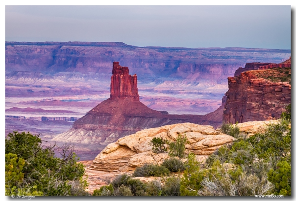
A scenic view into Canyonlands Nations Park in Utah. This is one amazing place. Author Edward Abbey, a frequent visitor, described the Canyonlands as “the most weird, wonderful, magical place on earth—there is nothing else like it anywhere
Canyonlands National Park is a U.S. National Park located in southeastern Utah near the town of Moab. It preserves a colorful landscape eroded into countless canyons, mesas, and buttes by the Colorado River, the Green River, and their respective tributaries. Legislation creating the park was signed into law by President Lyndon Johnson on September 12, 1964
The park is divided into four districts: the Island in the Sky, the Needles, the Maze, and the rivers themselves. While these areas share a primitive desert atmosphere, each retains its own character. Two large river canyons are carved into the Colorado Plateau by the Colorado River and Green River.
Interesting fact: Canyonlands is largely covered by cryptobiotic crust, a living soil, comprised of algae, lichens, and bacteria.
Scientific fact: Cataract Canyon may be one of the world’s most actively filling canyons. Scientists discovered 260 feet of sediment below the water’s surface.

Buy Royalty Free Stock Photography Images and Licensing HERE
Utah Fine art nature landscape photography and stock images by James Bo Insogna (C) – All Rights Reserved.

